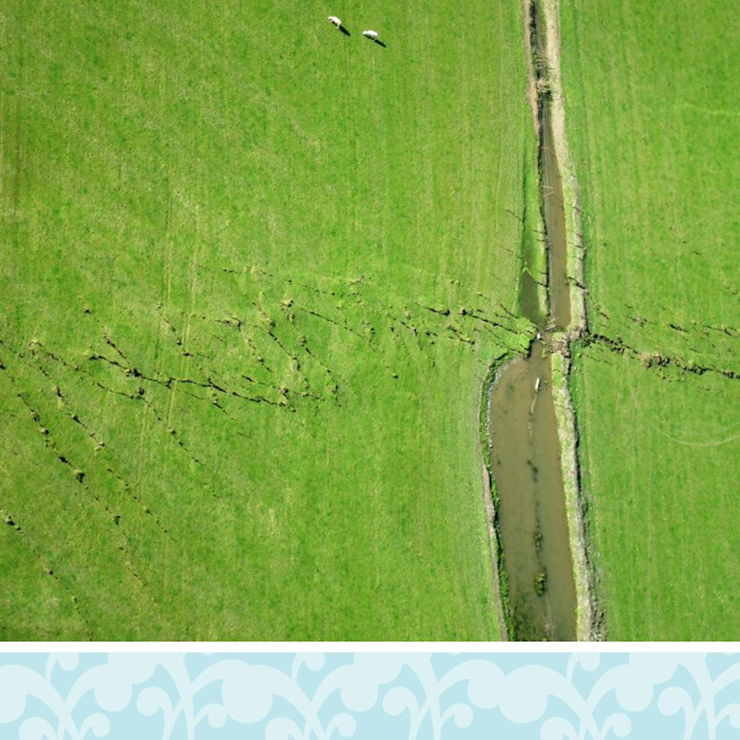
District-wide matter: Managing geotechnical risk

District Plan Review consultation now closed.
Initial public consultation on key draft changes to the current Selwyn District Plan closed on Monday 8 October 2018. Thank you to everyone who let us know what they thought of the review so far.
What’s next?
Following this initial public consultation on the District Plan Review, the Council will consider all feedback and start developing detailed provisions for the Proposed District Plan. Please note that a summary report on the initial public consultation will be made available on Your Say Selwyn website at www.selwyn.govt.nz/districtplanreview.
It’s expected the Proposed District Plan will beContinue reading
District Plan Review consultation now closed.
Initial public consultation on key draft changes to the current Selwyn District Plan closed on Monday 8 October 2018. Thank you to everyone who let us know what they thought of the review so far.
What’s next?
Following this initial public consultation on the District Plan Review, the Council will consider all feedback and start developing detailed provisions for the Proposed District Plan. Please note that a summary report on the initial public consultation will be made available on Your Say Selwyn website at www.selwyn.govt.nz/districtplanreview.
It’s expected the Proposed District Plan will be notified in early 2020 for formal public consultation. The longer timeframe is due to the local government elections at the end of 2019 and ensuring the newly elected Council endorses the Proposed District Plan before it gets notified.
We want to know what you think about the draft changes which affect how geotechnical risk in the district, in particular liquefaction, active faults, slope instability (eg rockfall) and earthworks, is managed in the future District Plan. These draft changes have been endorsed by the Selwyn District Council for further development as part of its District Plan Review.
How can I have a say?
To give us your feedback on the draft changes , you can:
- participate in our survey or ask us a question
- contact us directly via email districtplanreview@selwyn.govt.nz or call (03) 347 1856 .
There will be many consultation opportunities for feedback at different stages of the District Plan Review and this is the first such opportunity. It’s expected that the new District Plan will be notified in early 2020 and be fully in place, subject to any Environment Court appeals, in March 2022.
Background
Selwyn district runs from the east coast south of Christchurch, northwest through to the Southern Alps, crossing the Canterbury Plains. The geology, natural hazards and geotechnical hazards of the district are varied. In total, there are 24 areas in the district which contain either known or suspected active faults and folds. The main active earthquake faults in the district are Greendale, Porters-Amberley, Torlesse and Esk, and Cheeseman. The Alpine Fault is located approximately 15 kilometres beyond the district’s boundary (to the northwest).
The liquefaction hazard across the district is reliant upon the ground materials, groundwater levels and shaking intensity during earthquakes. Overall, the risk of damage from liquefaction in most of the Selwyn district is low.
Management of geotechnical risk in the current District Plan
The Council advises any person requesting a property’s Land Information Memoranda (LIM) of any known natural hazard affecting land. For example, properties in Arthur’s Pass have rock fall potential listed on their LIMs.
-
Key draft changes for the future District Plan
Share Key draft changes for the future District Plan on Facebook Share Key draft changes for the future District Plan on Twitter Share Key draft changes for the future District Plan on Linkedin Email Key draft changes for the future District Plan link
The Council’s District Plan Committee has endorsed the following draft changes for further development, which we’re now consulting on:
- Provide clearer, more comprehensive and integrated provisions that are specifically targeted at addressing geotechnical risk. This could include managing liquefaction, slope instability and active faults risk within a consistent framework that is also appropriate for other natural hazards, such as flood and coastal hazards in the district.
- Identify and map the following areas in the district:
- where known active faults lie (for example, develop fault avoidance and fault awareness areas), and
- where damaging liquefaction is more likely to occur should there be an earthquake. Once these areas are identified, develop detailed information about the impacts of this identification for an affected landowner. For example, the rules that would apply for subdivision and other development.
-
Further investigate the Port Hills and potentially Malvern Hills to identify where slope instability, ie rock fall, mass movement and soil erosion, is more likely to occur. This would then inform future development in these areas.
-
Summary of key issues with the current District Plan
Share Summary of key issues with the current District Plan on Facebook Share Summary of key issues with the current District Plan on Twitter Share Summary of key issues with the current District Plan on Linkedin Email Summary of key issues with the current District Plan linkAs a result of the review of current policies and rules specific to airfields, airstrips and helicopter landing pads, we’ve identified the following issues with the current District Plan:- Current approach to managing geotechnical risk within the current District Plan isn’t up to date and robust.
- Absence of a comprehensive risk-based approach to natural hazard management across the district and for different land uses.
- Few rules specifically dealing with geotechnical risk, particularly active faults.
- For managing geotechnical risk the current District Plan relies heavily on geotechnical assessments as part of the subdivision developments and plan changes for rezoning. However, not all subdivisions are required to provide a geotechnical assessment and many land development projects don’t involve subdivision.
-
While the district has active fault lines, areas
of known liquefaction susceptibility and areas of slope instability, there’s
little recognition in the Plan of these areas, although active faults are
included on the planning maps.


