District Plan Review consultation now closed.
Initial public consultation on key draft changes to the current Selwyn District Plan closed on Monday 8 October 2018. Thank you to everyone who let us know what they thought of the review so far.
What’s next?
Following this initial public consultation on the District Plan Review, the Council will consider all feedback and start developing detailed provisions for the Proposed District Plan. Please note that a summary report on the initial public consultation will be made available on Your Say Selwyn website at www.selwyn.govt.nz/districtplanreview.
It’s expected the Proposed District Plan will beContinue reading
District Plan Review consultation now closed.
Initial public consultation on key draft changes to the current Selwyn District Plan closed on Monday 8 October 2018. Thank you to everyone who let us know what they thought of the review so far.
What’s next?
Following this initial public consultation on the District Plan Review, the Council will consider all feedback and start developing detailed provisions for the Proposed District Plan. Please note that a summary report on the initial public consultation will be made available on Your Say Selwyn website at www.selwyn.govt.nz/districtplanreview.
It’s expected the Proposed District Plan will be notified in early 2020 for formal public consultation. The longer timeframe is due to the local government elections at the end of 2019 and ensuring the newly elected Council endorses the Proposed District Plan before it gets notified.
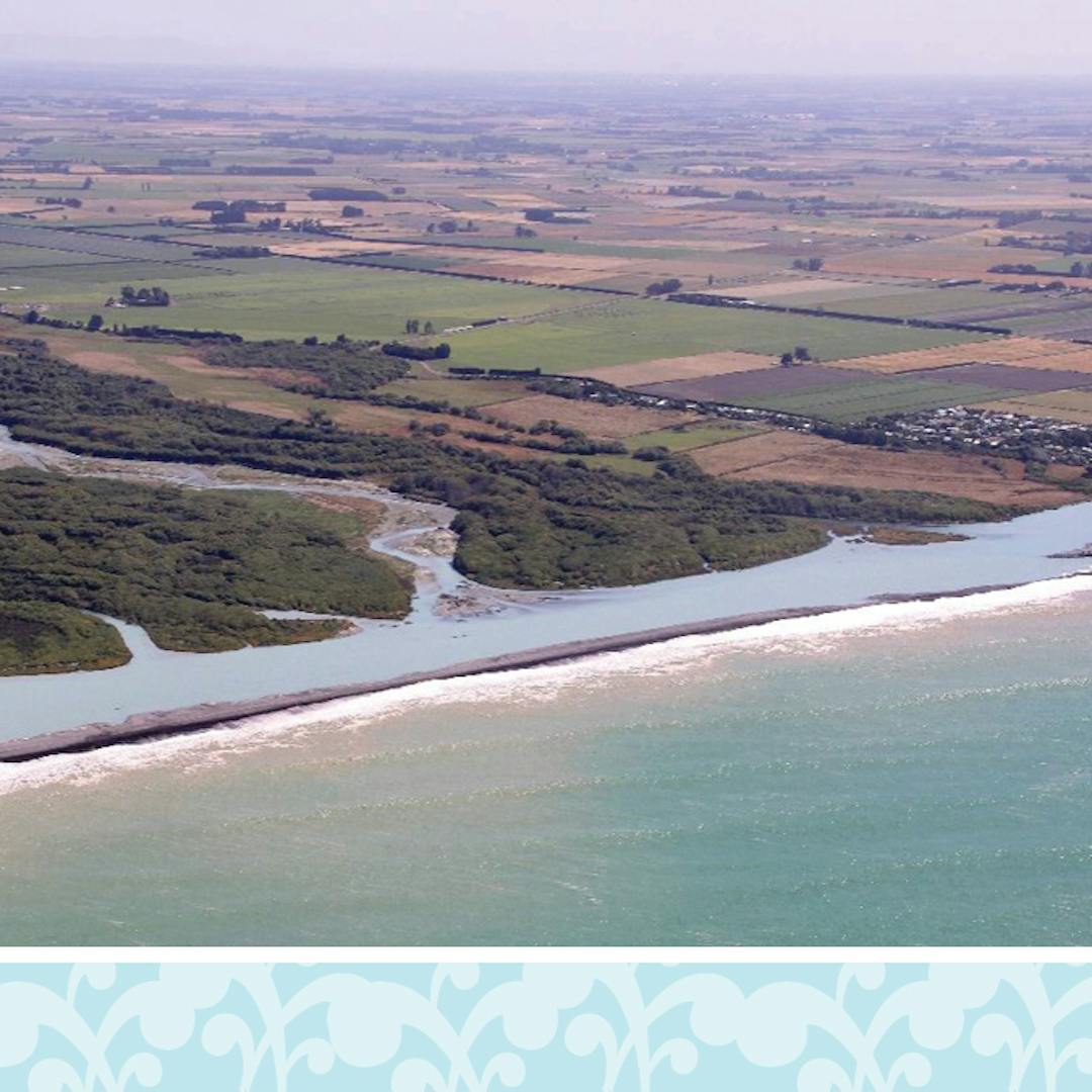
We want to know what affected landowners think about the draft changes to rules and policies which manage activities in the district's coastal environment and which the Council has recently endorsed for further development as part of its District Plan Review.
How can I have a say?
There are many ways for you to give us your feedback on the draft changes to coastal environment related provisions. You can:
There will be consultation opportunities for feedback at different stages of the District Plan Review and this is the first such opportunity. It’s expected that the new District Plan will be notified for formal public consultation in early 2020 and be fully in place, subject to any Environment Court appeals, in March 2022.
Background
As part of the current review, the Council has been reviewing whether the district’s coastal environment is properly identified and protected in the District Plan. We’ve also been looking at whether the rules for anyone wanting to develop or use the land in this area are clear and up to date with any relevant changes that have happened since the last District Plan was notified.
About coastal environment in the current District Plan
The Resource Management Act 1991, the New Zealand Coastal Policy Statement 2010 and the Canterbury Regional Policy Statement all require the Council to recognise the extent of the coastal environment in the district, and to have policies and rules which protect the values and character of the coastal environment.
Currently the land adjacent to the sea and Te Waihora/Lake Ellesmere is zoned Outer Plains (Rural Zone), except for the Rakaia Huts which are zoned residential (Living 1 Zone). Te Waihora/Lake Ellesmere is identified in the current Plan as an Outstanding Natural Feature and as a Wāhi Taonga Management Site.
The current District Plan has only one rule relating to the coastal area, which manages the erection of buildings seaward of the coastal hazard line as identified on planning maps.
The key issue identified during the review of the current District Plan is that the Plan doesn’t identify the extent of the district’s coastal environment, nor does it include any rules which protect the costal environment’s outstanding natural features, cultural values and natural character.