Share Key proposed flooding changes for the new District Plan on Facebook
Share Key proposed flooding changes for the new District Plan on X (formerly Twitter)
Share Key proposed flooding changes for the new District Plan on Linkedin
Email Key proposed flooding changes for the new District Plan link

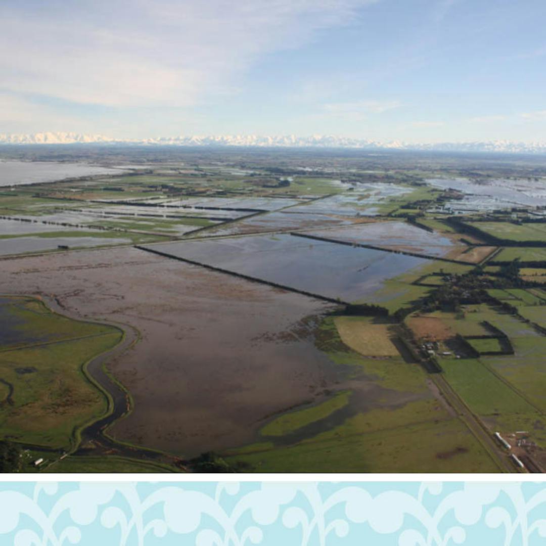
- Introduce newly mapped areas across the district that are at risk from flooding during a one-in-200-year flood event. These areas could have flooding at least five centimetres deep.
- Show all mapped areas on a map in the Proposed District Plan as part of a Plains Flood Management Overlay. This means that for these areas in addition to the underlying zone rules, specific rules would also apply.
- In line with the current practice, when there is a proposal to subdivide or build a new dwelling in an area at risk of flooding, a site-specific assessment would be requiredContinue reading
- Introduce newly mapped areas across the district that are at risk from flooding during a one-in-200-year flood event. These areas could have flooding at least five centimetres deep.
- Show all mapped areas on a map in the Proposed District Plan as part of a Plains Flood Management Overlay. This means that for these areas in addition to the underlying zone rules, specific rules would also apply.
- In line with the current practice, when there is a proposal to subdivide or build a new dwelling in an area at risk of flooding, a site-specific assessment would be required. The assessment would determine the required minimum floor height level of any new building.
- The district-wide minimum building floor height would be 300mm above a 200-year flood level event (instead of the current requirement of 300mm above a 50-year flood level event). In practice this means the floor level for a new dwelling would need to be higher than is currently required, although the amount of that increase would vary from place to place, depending on local conditions. For the majority of properties, the increase is likely to be only a few centimetres more than what is currently required.
- The site assessment would also look at whether the proposed building site meets the criteria for being in a ‘high hazard area’. If it does, then additional restrictions would apply. In some circumstances, where the flooding is particularly deep or fast-flowing, this may rule out building in that location.
- For work on an existing dwelling in an area at risk from flooding, no resource consent would be needed, as long as any new floor is of the same height as the floor in the existing building, or is at least 300mm above a 200-year flood level.
- For projects where the site assessment determines that the proposed building site is in a ‘high hazard area’, work on an existing dwelling would also still be permitted (ie no resource consent would be required), however the criteria would be slightly different:
there is no increase in the floor area of the building;
the building’s finished floor height is no lower than the finished floor height of the existing building; and
any reconstructed or replacement building is in substantially the same position as the original.
- To reflect the fact that a series of secondary stopbanks have been built along the Waimakariri River, the Waimakariri Flood Category A area would be amended so that:
- the land that is now protected by the secondary stopbanks is removed from the map, and
- the smaller area between the stopbanks where the high flood risk remains is renamed as the Waimakariri Flood Management Overlay.
- Subdividing or building a new residential unit or other principal buildings within the Waimakariri Flood Management Overlay would continue to be a non-complying activity. This means that a resource consent would be required and would be difficult to get.
Share Managing flood risk in the current District Plan on Facebook
Share Managing flood risk in the current District Plan on X (formerly Twitter)
Share Managing flood risk in the current District Plan on Linkedin
Email Managing flood risk in the current District Plan link

The current Selwyn District Plan identifies and manages the following rural flood areas:
- Waimakariri Flood Category A Area
- Waihora/Lake Ellesmere Flood Area
- Lower Plains Flood Area.
Within these rural areas the use, development and subdivision of land is restricted through consent requirements including:
- site-specific assessment of natural hazard risk;
- minimum floor levels for new dwellings and other principal buildings (eg commercial buildings); and
- controls on earthworks.
Within townships, only Tai Tapu and Rakaia Huts are currently subject to flooding controls. In Tai Tapu, new dwellings and principal buildings are subject to minimumContinue reading
The current Selwyn District Plan identifies and manages the following rural flood areas:
- Waimakariri Flood Category A Area
- Waihora/Lake Ellesmere Flood Area
- Lower Plains Flood Area.
Within these rural areas the use, development and subdivision of land is restricted through consent requirements including:
- site-specific assessment of natural hazard risk;
- minimum floor levels for new dwellings and other principal buildings (eg commercial buildings); and
- controls on earthworks.
Within townships, only Tai Tapu and Rakaia Huts are currently subject to flooding controls. In Tai Tapu, new dwellings and principal buildings are subject to minimum floor heights, while new dwellings or principal buildings on the lower terrace at Rakaia Huts are automatically a non-complying activity. This means that a resource consent would be required and would be difficult to get.
Key issues with the current District Plan
The key issue with the current District Plan is that the flood maps are based on information that is now over 20 years old and in several instances relies on information dating back to the 1970s. Also, the maps identify only areas known to have flooded in the past and areas at risk of flooding during a one-in-50-year flood event.
In the new Proposed District Plan we are required to identify and manage areas at risk from more extreme events: a one-in-200-year or a one-in-500-year flood. When identifying areas that could be susceptible to flooding, we also need to account for climate change effects over the next 100 years, such as increased frequency and intensity of rainstorms.


 Detailed factsheet on flooding hazards (3.41 MB) (PDF)